How it was done over the territory of Slovakia.
The Area Air Traffic Control office was located in an inconspicuous looking room on one side of the first hangar at the airport of
Ivanka in Bratislava. During a typical day shift there were two air traffic
controllers on duty, and two female telephone operators. In the neighbouring
office one or two females were keeping contacts with air taxis and operating radiotelephones, in the next office
there were several teletype machines, and in an office farther there sat a
telegraph operator. And at the end of the corridor was the office of two ATC
managers. Shown below are some of the personnel of the Area ATC in 1959 (Tibor
was at the Tower, Jano at the Area ATC, Sida, Vlasta, Valika and the two ?? were teletype operators); this is the
only photograph from those faraway days that I managed to find:

Essential responsibility of the Area ATC is to
ensure that all airplanes in the air over Slovakia are moving in mutually safe
distances, both horizontally and vertically.
The need to create such service became obvious
when both the number of airplanes in the air over Slovakia and their speed began to increase shortly after the second World War. Initially, the service was
provided by a network of ground telegraph and radio signal transmitting
stations (gonio, Adcock). The density of air traffic, accompanied by the
increasing speed of airplanes in the air, required re-organisation of such
system by creating air traffic control centres. The centres initially relied on
the existing communication and ranging networks, that is that telegraphy was
still being used for communication with the airplanes; likewise, the
geographical locations of airplanes were often determined by acquiring various bearings
using adjustable antennas of ground telegraphic stations. The system began to lag
behind the requirements of modern-day air traffic, and in the 19-fifties
ground-to-air communication began to use radiotelephones; locations of airplanes
began to be determined by means of ground-based transmitters, be they standard
commercial radio stations transmitters, or radio beacons built in specific
locations; radars were also becoming available.
At the Area Control Centre, a sheet of
paper about 800 x 100mm was used for graphic recording of aircraft movements.
The paper was divided vertically into two halves, where the left half
represented one day from 00 hours to 1200 hours, the right half from 1200 to
midnight. The halves were further divided into 12 parts, each part representing
one hour; distance was read horizontally, where each square represented 5
kilometres (each square vertically represented 5 minutes, I think). It
would be nice to have just one piece of
such paper to jolt the memory... Here’s my attempt at re-creating such paper:

The system was
fairly ingenious, and an experienced operator was able to evaluate air traffic
over the territory of Slovakia at a glance, both in the past, present, and in the
near future.
Referring to the
diagram, for example, an operator starts his shift at 1100 o’clock. At the
first glance he finds out that three airplanes left the area under his control
by flying over Štúrovo into Hungary at 1030
and 1037 resp., and also over Brno at 1042; one airplane is in his area by
entering it over Štúrovo at 1058 from Hungary,
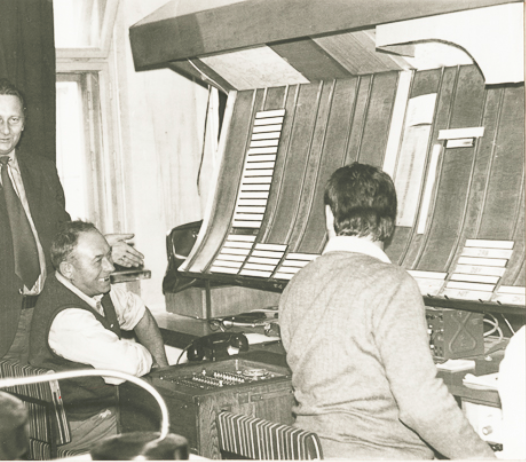
and, finally, one airplane would enter his area at 1113.From those days I have but one photograph with the typical day shift personnel. Marek stands behind the desk with the sheet of paper described above. Behind Marek hangs drapery hiding radar screen. The radio telephone operator Luba sits on the left, two telephone operators on the right:

The Controller’s main task was to record on the ruled sheet of paper in front of him the expected or actual times of airplanes above the numerous radio navigational points in his area (on the diagram above they are Brno, Nitra and Štúrovo). From the information recorded in front of him he would allocate flight levels to the airplanes so that minimum prescribed separation between all flights is ensured.
For clarity diagram and the description in the paragraph above are both severely simplified. Missing are details of airplanes (call sign, airline, from-and-to, flight level, etc.), and many radio navigational and other points (Sliač, Jelšava, Košice, Poprad, Dubové, Jablonka, etc.). Many radio-navigational points were known by their Morse code call signs: for instance, Štúrovo was known as OKI, i.e. ---/-.-/.., Nitra as NIT, etc.
The graphic system based on the diagram above was used up to the year (about) 1965, when it was superseded by the so-called Strip system. In this system the information about airplanes was written on pre-printed strips of hard paper, inserted into holders and laid according to the time on a slanting board in front of the Controller (thank you, Marek Sibik):
And how the Office looks today (thank you, Pavel B.):

No comments:
Post a Comment